Story Mapped
Submitted by geobugOver the course of the last year, I've been working on a bit of research with a friend from work. We built our final model into a story map and released it into the wilds of the internet this week.
This big project all started with my GISP actually. In order to qualify for GISP certification, you have to do a certain amount of community contributions. Public outreach, publications, talks, that sort of thing. In looking around for a project, I found myself knocking on a couple of doors around the office, the folks I really like to work with. I work with an exceptionally smart group of folks and just about everybody's got a research project going or an idea cooking in the back of their heads. My first stop was my buddy Brian who knows more about San Francisco prehistory than anyone I know, and in the eight years that I've been with the company, I've learned that we collaborate pretty well.
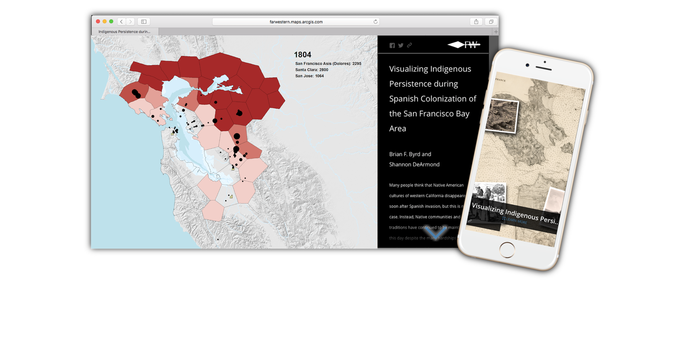
And Brian had a good idea. We set out to model the indigenous population of the San Francisco Bay area as it was affected by the Spanish missions. One of the really cool things about this project is how the data led the research. I build a time-based population model in ArcGIS using python based on mission records. In messing around with the best way to show migrations in those kind of staggering numbers, I spit out a version with a proportional dot size based on migration group size. Brian and I watched it together.
"That looks like a trend."
"Sure does."
"Can you dump out a table based on group size?"
"Yep."
"Let's check the numbers."
It turns out the story the data was telling was deeper than the one we had set out to visualize. Cross-referenced with carbon sample data and other archaeological evidence and we had an interesting bit of research and a dynamic way to show it off.
It was a lot of late night emails and weekends spent debugging scripts. And it serves as a great example of what happens when smart folks from different disciplines put their heads together and see what they can build. Which is of course what makes GIS awesome. It is multidisciplinary by its very nature.
A shout-out to Far Western who was super supportive of our pet project and all the folks there and elsewhere who contributed to our peer review process. And a special shout-out to our spouses Seetha and Shawn who helped us edit text and CSS alike to make the story come alive.
I'm pretty proud of it. And now I need a new project...